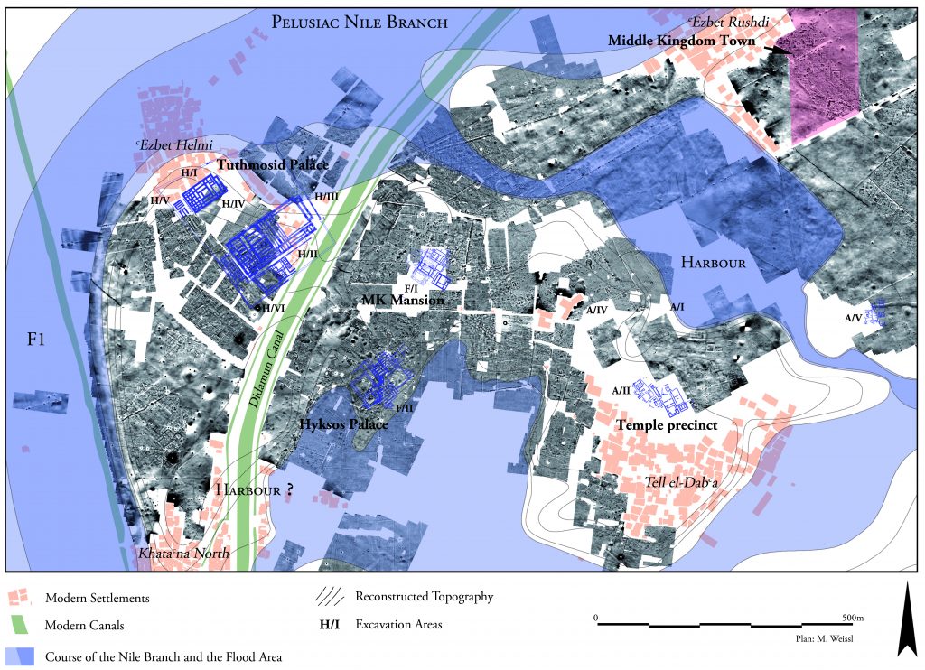
A Complex Near Eastern Stratigraphy at Tell el-Dab‘a (Area A/II)
The objective of this project is the exploration and collation of results regarding the stratigraphy of settlement phases of Area A/II at Tell el-Dab‘a, located in the Eastern Delta of Egypt. Excavations carried out at Tell el-Dab‘a from 1966 onwards under the direction of Manfred Bietak not only revealed a significant harbour site founded in the early 12th Dynasty (Middle Kingdom, c. 2000 BCE), but also a town inhabited already towards the end of this dynasty by multi-ethnic groups, the most significant one of Near Eastern provenance. The settlement displays therefore a cultural mix of Near Eastern Middle Bronze Age and Egyptian cultural elements according to material remains, burial customs and architectural features.
As a trade hub, finds and imports from the Levant, Cyprus and the Aegean offer the unique possibility to reconstruct trade flows and its changing capacities in the course of time. As a result of this substantial influx of a foreign population, the site later became Avaris, the capital of the 14th and 15th Dynasties, the latter known as Hyksos, rulers of non-Egyptian origin. In this so called Second Intermediate Period (c. 1640-1530 BCE) the North of Egypt and, in consequence the trade with the Mediterranean, was controlled by foreigners.
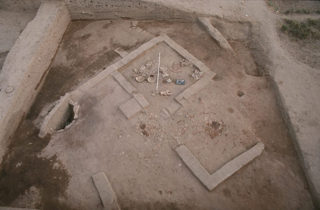
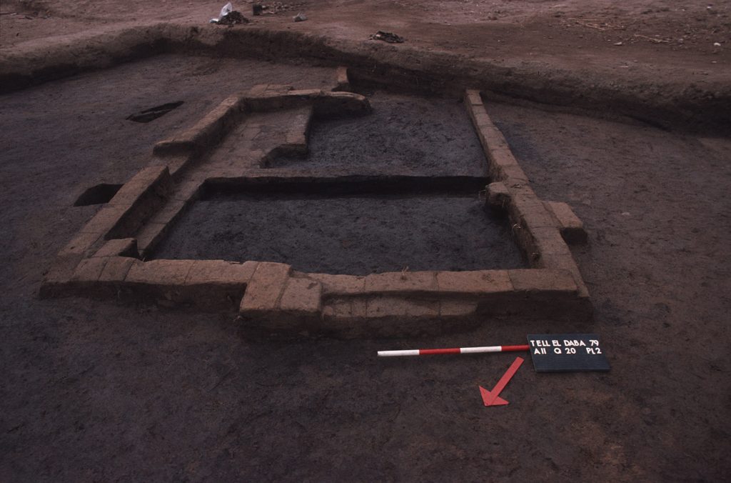
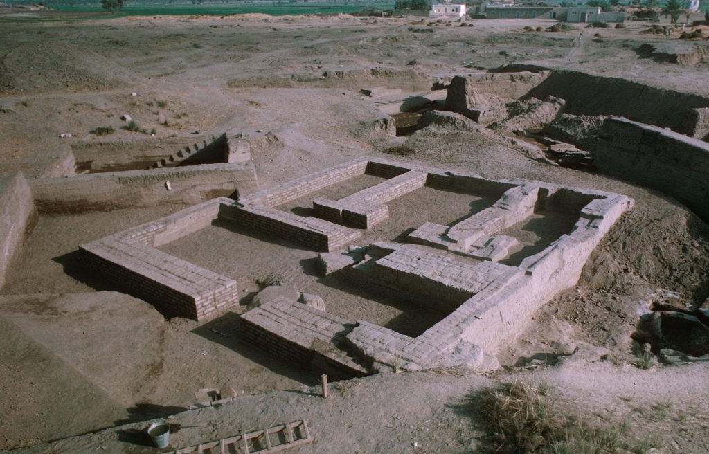
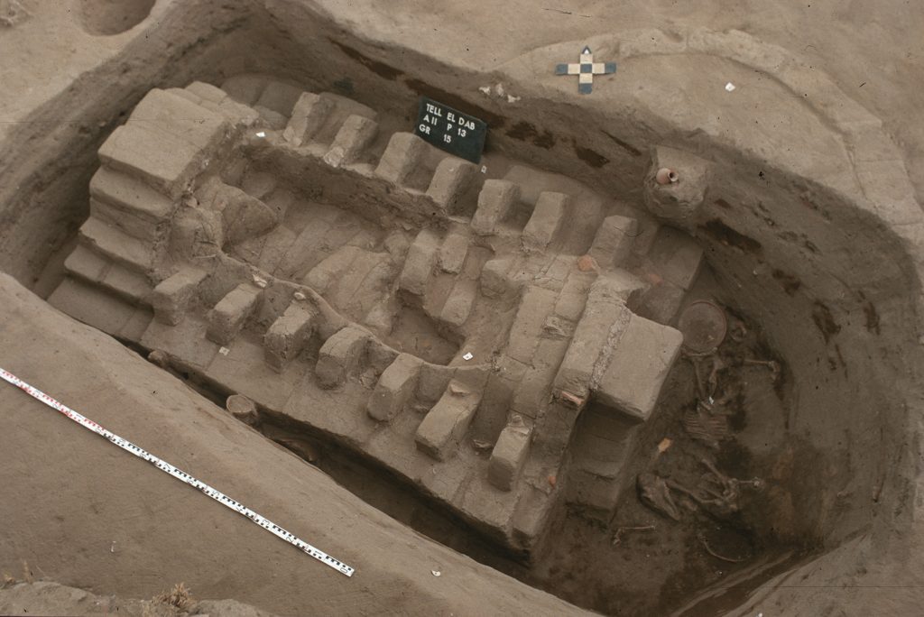
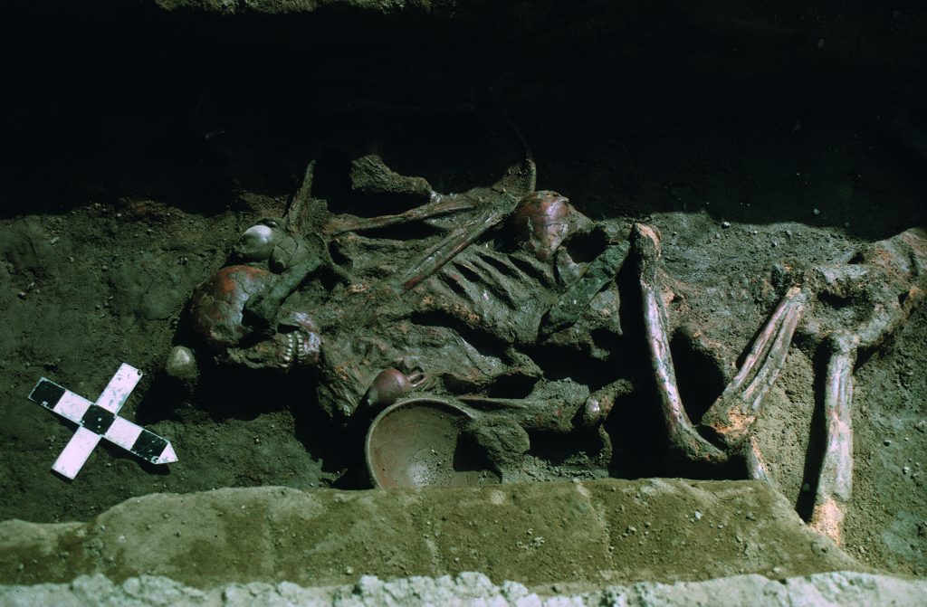
The occupational layers at the site have accumulated on so-called ‘turtlebacks’ near the easternmost Nile branch and show a horizontal and a vertical development. The occupation in this area started in the late 12th Dynasty with houses inhabited by a Near Eastern population adopting Egyptian cultural elements, but retaining their customs in funerary and religious spheres, such as the practice of intramural or weapon burials. A crisis appears to have struck the settlement during the late Middle Kingdom (c. 1750 BCE), perhaps due to an epidemic or political turmoil.
The eastern part of the town and also Area A/II seem to have been abandoned despite the continuation of occupation in other areas of the settlement. Following this abandonment, the space was transformed into a sacred precinct with temples of Near Eastern type with adjacent cemeteries. These were encroached again by later settlement and burial activities. Only the major Temple III and an Egyptian type temple in the east of the area were kept intact. The others gave way to domestic buildings during the Second Intermediate Period, when tombs were installed within houses or courtyards. The area was abandoned at the end of the Hyksos Period. Only the sacred precinct seems to have been respected and was continuously used into the New Kingdom.
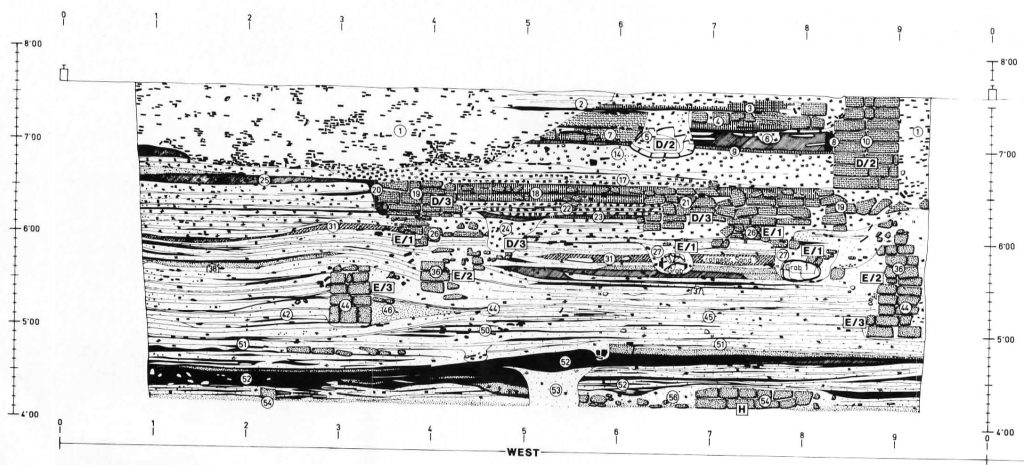
The task of this project is to reconstruct the development of this settlement from the complexity of accumulated layers, to build a framework for the stratigraphic attribution of domestic and sacred architecture, waste accumulation, offering pits and tombs, including the digital transformation of the excavation’s documentation.